
Why Greenlee is the best Arizona county to live in?
Out of Arizona’s 15 counties, only one can be the best, and a new ranking claims to have found it. Greenlee CountyContinue Reading

Does the name Stonebridge Ring a Bell?
Two sisters and their cousin, with the maiden name of Stonebridge, came in to the visitors center with a scrapbook of memoriesContinue Reading

Discover Greenlee Newsletter | June 2024
If you are not able to see the newsletter, try this link: https://mailchi.mp/32e2e9979f7f/discover-greenlee-10313852Continue Reading

Fiesta Latina Coming June 6-9 at WNMU
Western New Mexico University acknowledges the deep roots New Mexico shares withMexico. The territory of New Mexico gained statehood in 1912, yetContinue Reading
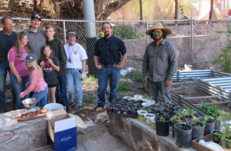
Greenlee Gardens – Clifton Site
It may be called Greenlee Gardens – Clifton Site, but over the last decade we have gardened with residents from all partsContinue Reading
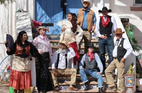
Murder and Mystery Dinner Theater was a success!
Murder and mystery, a dinner theater, with the Greenlee County Players and presented by The Clifton Cliffhanger, at the Art Depot wasContinue Reading