Search for fire agate and geodes in first class rockhounding areas!
Ash Peak is adjacent US 70, “The Old West Highway”, as you enter Greenlee County on the west side. Explore the valley below the peak with a visit to the Ash Peak Mining District. Visit the old mines and find a wash full of geodes eroding out of the banks. Within a couple of minutes you can find hollow geodes full of crystals. Across the highway heading into Ash Peak Canyon you will find even more “prospective” rockhounding sites to behold. Don’t forget your pick and bucket to help scratch that rockhounding itch. Visit Round Mountain BLM Rockhound Area next for more rockhounding in Greenlee County.
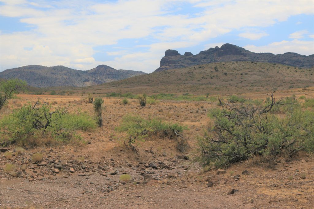
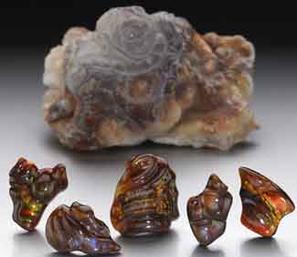
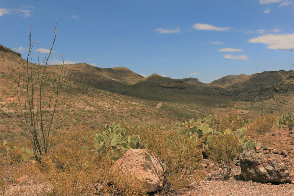
Round Mountain BLM Rockhound Area is one of the nation’s largest rockhounding sites for the elusive Fire Agate — nature’s pearl of the desert. Find fire agate, quartz crystal rose, geodes and many more specimens amongst a snow-like blanket field of chalcedony just waiting to be picked up off the ground. No need to dig within this rockhounders “field of dreams”!
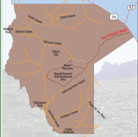
Eleven miles east on US 70 from Duncan and seven miles southwest on Lazy B Ranch Road (near New Mexico US 70 MP 5). BLM rules, regulations and tips for preparing yourself for a self-guided tour of Round Mountain can be found at http://www.blm.gov/az/st/en/prog/recreation/rockhnd/locations/round_mtn.html
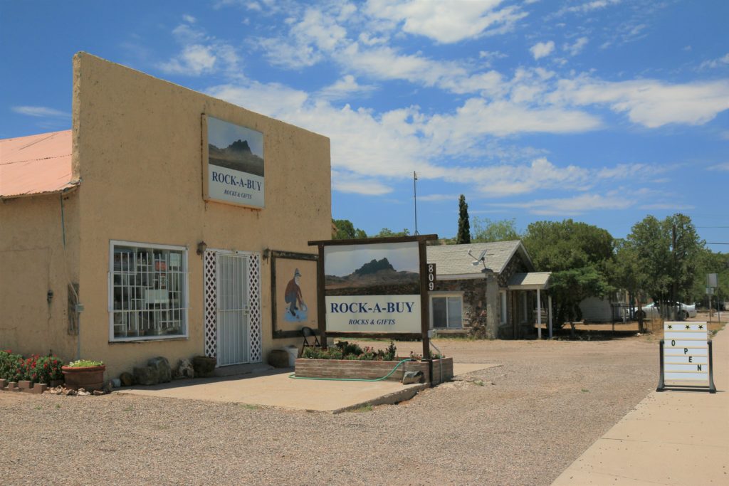
Definitely stop by Rock-A-Buy Rocks and Gifts in Duncan to get thelatest updates on rock hounding conditions and the places to look. They also offer knowledgeable guided tours of the Round Mountain BLM Rockhound Area. For more information or to schedule a guided tour please contact Doug (928) 215-9912 or visit www.rockabuyrocksandgifts.com
Carlisle Mining District Area – Rockhounding. Referenced by many mining district names such as Duncan , Carlisle, Steeple Rock, Goat Camp, etc., this rockhound area is a magnificent set of world-class deposit sites for fluorite. Fluorite ore is a very hard, bluish-white quartz. Manganese, calcite, quartz crystals of many colors and a variety of collectable specimens are also found throughout the entire district. Accessible by way of traveling various dirt roads on BLM lands, the more suitable is the Carlisle Road out of North Duncan easily traveled by use of a high-clearance vehicle, though 4WD is always recommended. Please be respectful of private property and cautious when viewing any mining areas.
Mulligan Peak is a scenic landscape to behold by way of Ward Canyon Road, and another well-known rockhound collection site of Greenlee County. Two chalcedony beds of purple agate are found around the peak, on the northeast and southwest sides. Mulligan Peak’s purple agates can be found by careful digging and are recognized by bands of color ranging from lavender to deep purple and gray. These nodules can also be found with many specks of white.
Painted Bluff Trail #13. Trailhead is located on the west side of the Coronado Trail (US 191), MP 177. Rockhounding opportunities for minerals such as pyrite can be explored along the Coronado Mountain Ridge. Head west toward the lower portion of Eagle Creek to view such attractions as ancient petroglyphs located on Painted Bluffs and abandoned mines and springs throughout the journey. Also enjoy hiking, biking, or horseback riding along this trail.
Limestone Gulch Rockhounding area. Access to Trail #84 with its junction to trail #311 can be reached by hiking northeast up Limestone Gulch after crossing the San Francisco River near the north end of Frisco Avenue in Clifton. Alternate access can be reached in connection with FR 512A junction with FR 512 traveling northeast from the community of Loma Linda.
Black Hills Rockhound Area – Only a couple miles from the MP 139 entrance to the Black Hills Backcountry Byway (in Graham County) a sign directs you down a graveled side road to the rockhounding area. This area is below bands of greenish-yellow tuff.
Gila Lower Box Wilderness Study Area is a desert oasis just over the border in New Mexico. Rockhounding is abundant within the Caprock Mining District Area, and has been found to be resplendent with small veins of manganese. The Gila River is accessible throughout this five-mile long, up to 600 feet deep river cut canyon. Access these outdoor-enthusiast attractions by heading northeast of Duncan on Old West Highway 70 to Fuller Road. Heading northwest onto White Rock Canyon Road from Fuller Road gains access to the Gila Lower Box WSA trails and Fisherman’s Point at the gravel road’s end.
Fisherman’s Point and White Rock Canyon are known for castle-like sheer rock walls and pillar rock formations found by way of following the course of the Gila River west of Fisherman’s Point. Access the Gila River Canyon via Fisherman’s Point for an enchanting experience to reach White Rock Canyon and beyond.
Cottonwood Canyon is locally well known for its amazing historical Indian petroglyphs — wonders that have withstood the test of time in the high desert for centuries. Access Cottonwood Canyon where it joins the Gila River Canyon below Canador Peak for views of these writings.